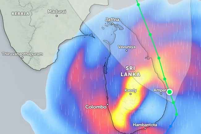
November 29, Colombo (LNW): The weather authorities have reported that Cyclonic Storm Ditwah was tracking just northwest of Trincomalee late on the night of November 28, positioned close to latitude 9.0°N and longitude 80.8°E. At the time of observation, the system was situated roughly 70 kilometres offshore and continuing to intensify.
Forecast models suggest the cyclone is expected to drift north–northwest, heading towards the Tamil Nadu coastline in India by 30 November. Although the system is moving away from Sri Lanka, its outer bands are still influencing local weather conditions, prompting officials to urge the public to follow updates from the Department of Meteorology closely.
Despite the lingering effects of the storm, meteorologists anticipate a noticeable reduction in widespread rainfall by tomorrow. However, intermittent showers and thunderstorms are still expected across the Northern, North-Central, Central, and North-Western provinces, with isolated areas potentially receiving more than 100 mm of rain.
Sabaragamuwa and the Western Province, along with Galle and Matara, may also see spells of rain or thunderstorms, with some locations likely to experience rainfall in excess of 50 mm. Other regions across the island could also witness scattered showers as conditions fluctuate.
In addition to the rain, strong winds remain a significant concern. Gusts of 60–70 km/h, occasionally strengthening to nearly 90 km/h, are possible in many parts of the country as the cyclone continues its passage.
Authorities have encouraged residents to take all necessary precautions, particularly in areas prone to flooding, falling trees, or structural damage, as the island weathers the storm’s trailing impact.
