
By: Isuru Parakrama
May 23, Colombo (LNW): Due to the south-west monsoon that has established over the island, the prevailing rain and wind conditions are expected to continue further, the Department of Meteorology said in a ‘Red Notice’ statement in its weather forecast today (23).
Very heavy showers about 150 mm are likely at some places in Sabaragamuwa province and in Kandy and Nuwara-Eliya districts, the statement added.
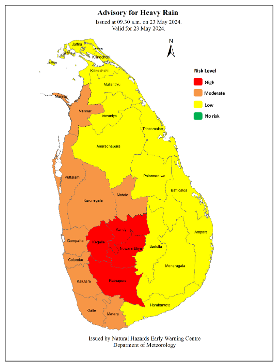
Heavy showers above 100 mm are likely at some places in Western and North-western provinces and in Mannar, Galle and Matara districts.
Meanwhile, the sea areas extending from Colombo to Pottuvil via Galle and Hambantota will be very rough at times with very strong gusty winds up to (60-70) kmph.
Naval and fishing communities are advised not to venture into the sea areas extending from Colombo to Pottuvil via Galle and Hambantota, until further notice.
The sea areas extending from Kalpitiya to Colombo will be rough at times with strong gusty winds up to 60 kmph. The naval and fishing communities who are engaged in fishing and naval activities in the above sea areas are requested to be vigilant in this regard.
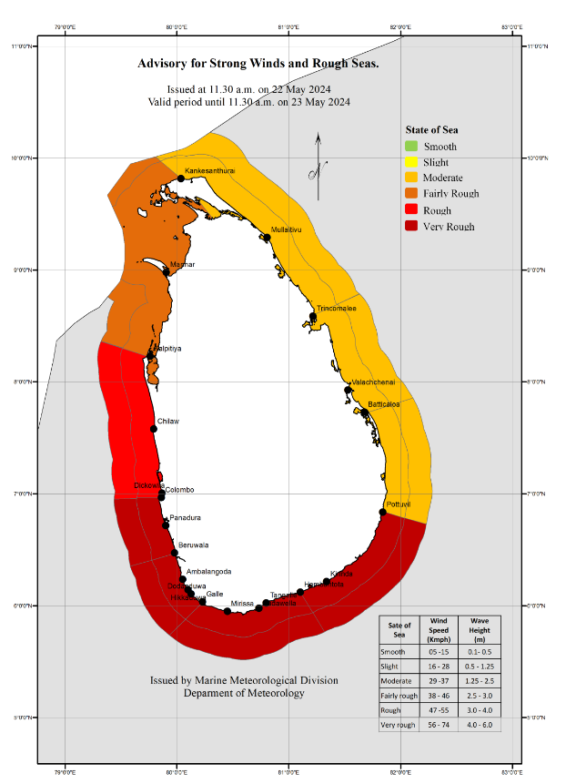
Showers or thundershowers will occur at times in these sea areas and heavy showers may occur at some places.
The swell waves (about 2.5 m – 3.0 m) height (This is not for land area) may increase in the sea areas off the coast extending from Kalpitiya to Pottuvil via Colombo, Galle, and Hambantota.
There is a possibility that near shore sea areas off the coast extending from Colombo to Matara via Galle, may experience surges due to swell waves.
Naval and fishing communities are also requested to be attentive to future forecasts issued by the Department in this regard.
A low-level atmospheric disturbance in the south west Bay of Bengal area has intensified in to a low-pressure area. It is very likely to move northeastward and concentrate into a depression over the central parts of the Bay of Bengal by May 24, 2024. Then it would continue to move northeastward and intensify further.
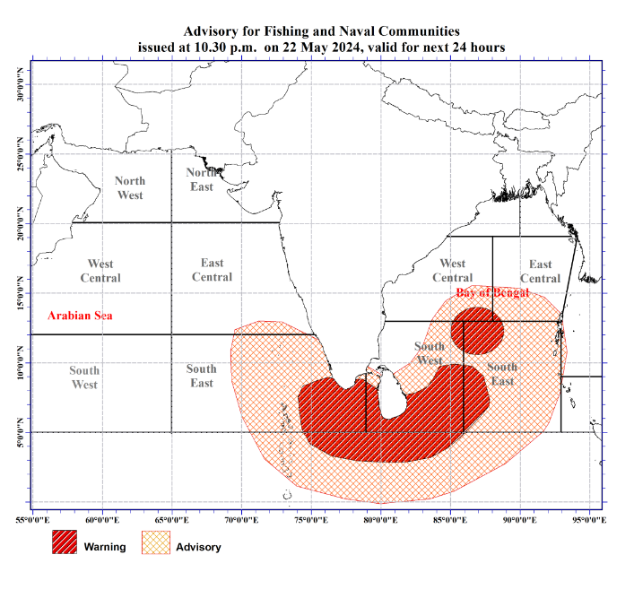
Very strong winds (60-70) kmph, accompanied with heavy rainfalls and very rough seas are likely over the sea areas around the country and over the South-eastern Arabian Sea areas and southwestern Bay of Bengal Sea areas. Naval and fishing communities are advised not to venture into the sea areas marked by RED colour on the map below until further notice. Those who are out at aforementioned sea regions are advised to return to coasts or moved safer areas immediately.
Naval and fishing communities are also requested to be attentive to future forecasts issued by the Department in this regard.