By: Isuru Parakrama
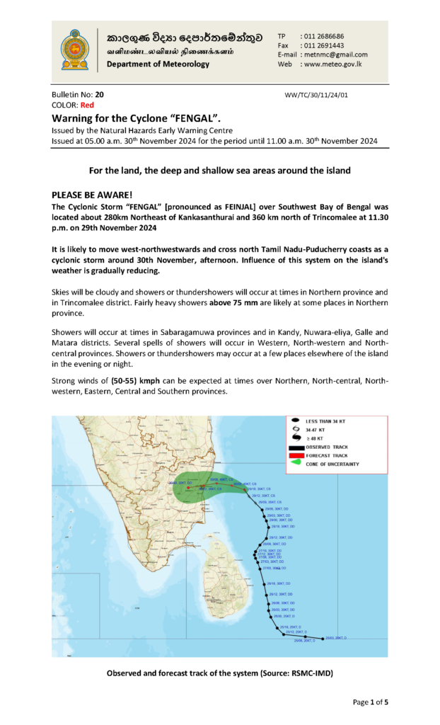
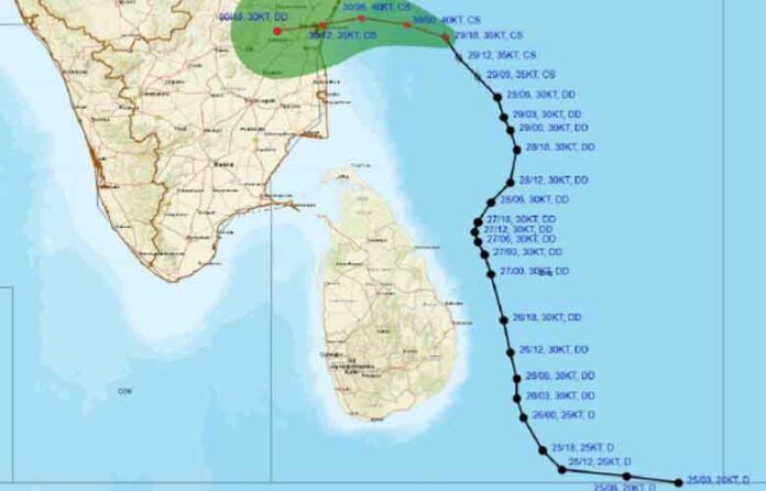
November 30, Colombo (LNW): The Cyclonic Storm “FENGAL” over the Southwest Bay of Bengal was located about 360 km north of Trincomalee and 280km Northeast of Kankasanthurai at 11.30 p.m. yesterdday (29), and it, therefore, is likely to move west-northwestwards and cross north Tamil Nadu-Puducherry coasts as a cyclonic storm around this afternoon (30), the Department of Meteorology said in its daily weather forecast today.
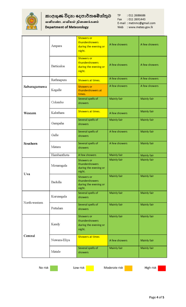
In statement, the Department added that the influence of this system on the island’s weather is gradually reducing, and skies will be cloudy and showers or thundershowers will occur at times in Northern province and in Trincomalee district.
Fairly heavy showers above 75 mm are likely at some places in Northern province, the statement read.
Showers will occur at times in Sabaragamuwa provinces and in Kandy, Nuwara-eliya, Galle and Matara districts. Several spells of showers will occur in Western, North-western and North-central provinces.
Showers or thundershowers may occur at a few places elsewhere of the island in the evening or night.
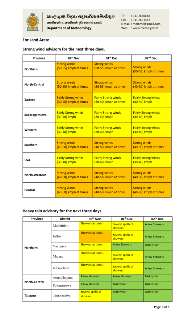
Strong winds of (50-55) kmph can be expected at times over Northern, North-central, North-western, Eastern, Central and Southern provinces.
The general public is kindly requested to take adequate precautions minimise damages caused by temporary localised strong winds and lightning during thundershowers.
Marine Weather:
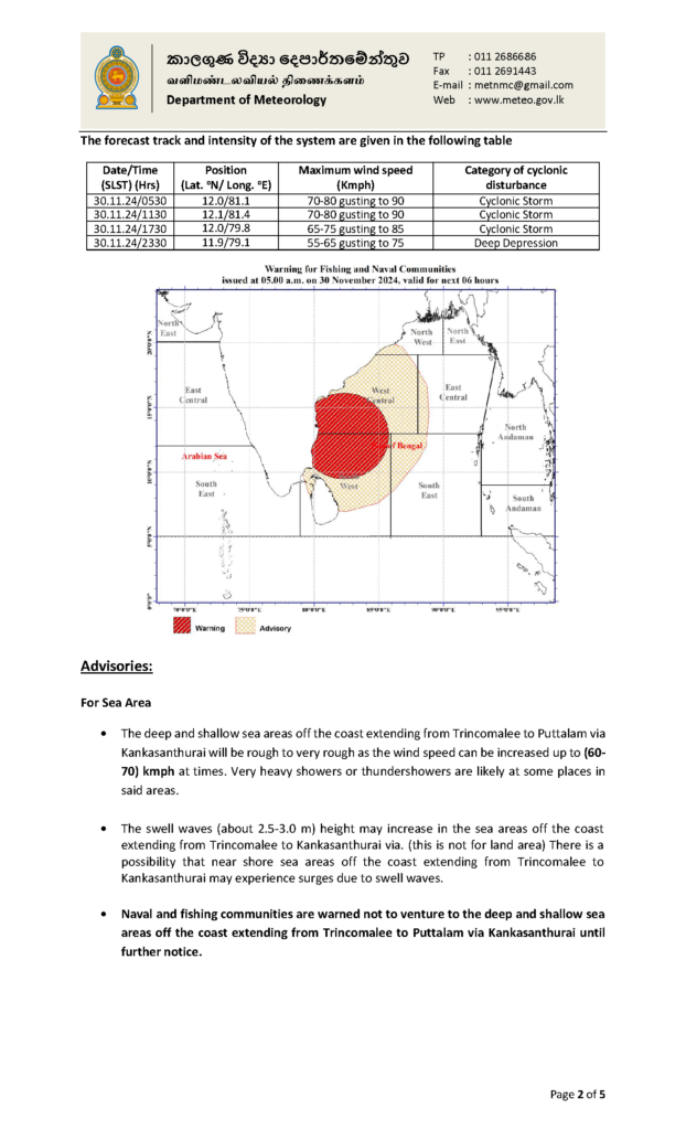
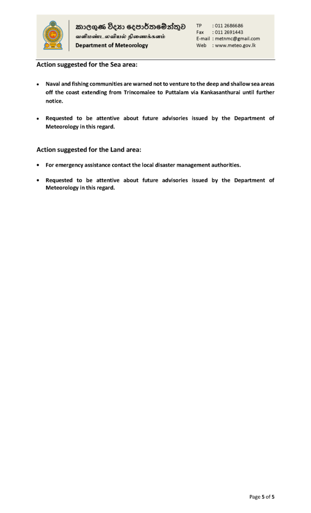
| Naval and fishing communities are warned not to venture to the deep and shallow seaareas extending from Puttalam to Trincomalee via Kankasanthurai until further notice and be vigilant on this regard in the other sea areas around the island. |
| Condition of Rain: |
| Showers or thundershowers will occur at times in the sea areas around the island. Heavy showers are likely in the sea areas extending from Kankasanthurai to Trincomalee. |
| Winds: |
| Winds will be North-westerly to South-westerly in to the sea areas around the island. Wind speed will be (40-50) kmphin the sea areas around the island. Wind speed can increase up to (60-70) kmph at times in the sea areas extending from Puttalam to Trincomalee via Kankasanthurai. |
| State of Sea: |
| The sea areas extending from Puttalam to Trincomalee via Kankasanthurai will be rough to very rough at times. The other sea areas around the island will be fairly rough at times. The swell waves (about 2.5–3.0 m) height (this is not for land area) may increase in the sea areas off the coast extending from Trincomalee to Kankasanthurai. There is a possibility that near shore sea areas off the coast extending from Trincomalee to Kankasanthurai via may experience surges due to swell waves. Temporarily strong gusty winds and very rough seas can be expected during thundershowers. |
